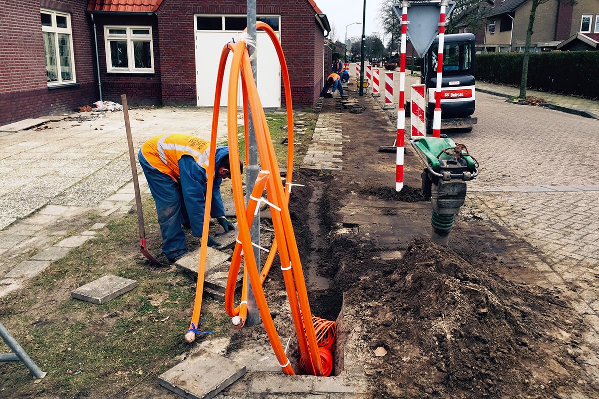
Discover how new technology enables proactive management of utility projects, permitting, incidents, traffic and events. For example, enhanced electronic white lining allows an excavator to click a link, view an aerial image of the excavation location, and then draw a white line on the image to delineate the proposed dig site. Once onsite, the locate technician can pull up this image and see exactly where the dig will occur.
Learning Objectives:
- Identify how technology is assisting public works agencies to communicate and coordinate utility projects within the public right-of-way.
- Discover how the online locate request offers big advantages and huge benefits.
- Evaluate how virtual white lining can define accurate excavation location with confidence.
Contributor/Source
Derrick Saedal
Claim CEUs
Submit this form to claim CEUs.
Proficiency Levels
Introductory
Focuses on a general or broad overview of the topic, awareness of basic factual recall. Limited experience of the subject matter is necessary to understand content areas.
Applied
Focuses on practical implementation of technical steps or strategies, some prior knowledge and experience of the topic is necessary.
Advanced
Mastery of basic concepts associated with an area has been obtained. Focuses on understanding nuances, advanced concepts, and intricacies with implementation within knowledge area. Strong understanding of how the concept impacts other factors or areas of operations.
Program Types
APWA Guides
APWA Guides provide guidance to public works professionals on a specific a topic.
CLL
Click, Listen & Learn (CLL) are interactive educational webinars. Each program is led by top experts in the field who share new ideas, methods, and technologies in a fast-paced two-hour time frame. These programs are available free to APWA members. CLL programs are eligible for continuing education units (CEUs).
Primer
Primers are used to educate policymakers about public works roles and responsibilities in public rights of way, the impact of federal workforce development policies on the industry and workforce, and the importance of resilient infrastructure.
PWX
PWX session recordings cover a wide variety of topics, including integrating modes of transportation, traffic and transit, construction management, emergency management, engineering and technology, fleet and facilities, management, parks and grounds, snow and ice control, and stormwater/flood control, as well as solid waste, roads and bridges and water/wastewater. PWX sessions are eligible for continuing education units (CEUs).
Reporter Articles
APWA Reporter articles are written by public works practitioners on subjects such as solid waste management, water resources, municipal engineering, transportation, equipment services, buildings and grounds, snow removal, and other public works-related topics.
Snow
The Snow Conference session recordings feature public works professionals sharing the latest best practices in managing winter/snow operations more successfully, taking advantage of emerging technologies, understanding and preparing for the challenges ahead, and providing better service to their communities. Snow sessions are eligible for continuing education units (CEUs).
Tech Boxes
A tech box is a PDF take-away that provides information in lists, steps, or defined areas specifically focused on trending technologies.
Toolbox
Toolboxes are curated guides offering valuable tips on a variety of public works-related topics.